
Blog
Understanding GNSS Pt 1
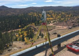
Image above: The author performs deformation monitoring on a Colorado reservoir with a Leica TS15. Pt. 1: Ellipsoids, Datums, and Realizations Land surveying is one of the oldest professions to exist throughout the world. Evidence of its use can be found dating as far back as 2700 BC when the Great Pyramid of Giza was...
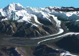
Mapping Alaska with IFSAR
A group of companies overcomes Alaska’s many mapping problems using coordinated teamwork and IFSAR. In 2008, Alaska had never been mapped at any scale to National Map Accuracy Standards, and it was the only state with no statewide orthophotos. Dewberry (a national geospatial company headquartered in Virginia) had written the National Height Modernization Study: Report...
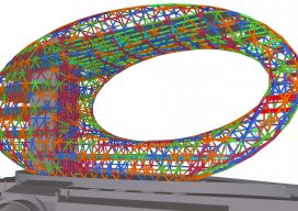
Logic inside the Labyrinth of BIM
An overview of a BIM solutions portfolio reveals the essential components for widespread implementation. Are you tired of hearing about BIM yet? Get used to it. The widespread adoption of BIM is quickly becoming an inevitability, with compelling drivers and essential tools already in place. In some economies, BIM has already been mandated for public...

XR – A New Mix
Mixed reality for infrastructure and geospatial takes a huge leap forward with the announcement of the HoloLens 2, SYNCHRO XR, and the XR10. This might sound a little cliché, but forget everything you knew about Microsoft’s HoloLens. The new model makes the first model seem like a toy (albeit a very cool toy). A not-so-surprising...
xyHt Magazine Heights 2019 Issue
Click on the cover below to view the Heights 2019 issue of xyHt magazine. Articles in the issue include (links will turn live throughout April): Mapping Alaska with IFSAR – A group of companies overcomes Alaska’s many mapping problems using coordinated teamwork and IFSAR. Airports GIS – The history and complexities of AGIS from the expertise of a...
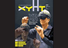
xyHt Magazine April 2019 Issue
Click on the cover below to view the April 2019 issue of xyHt magazine. Articles in the issue include (links will turn live throughout April): A New Mix – Mixed reality for infrastructure and geospatial takes a huge leap forward with the announcement of the HoloLens 2, SYNCHRO XR, and the XR10. Logic inside the BIM Labyrinth – An...
Advertisement