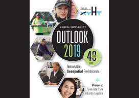
Blog

Aaron Morris, PhD
PhD Roboticist; Co-Founder & CEO, Allvision IO Pennsylvania, USA Aaron Morris earned his doctorate in robotics at Carnegie Mellon University, where robotics and related research and enterprises are continuing to increase in prominence. Morris formed Allpoint Systems in 2009 in CMU’s hometown of Pittsburgh as a startup specializing in data processing for 3D for robotics,...

Anna Riddell
Geodetic Scientist & PhD Candidate, University of Tasmania Tasmania, Australia The fact that Earth does not sit still—that it shrinks, swells, and wiggles—has so captured the imagination of Anna Riddell that she chose a career in geodesy (and has the Twitter handle @Wiggly_Earth). During high school when Riddell began thinking about careers, she knew that...

Muhammad Luqman
PhD Student, University of Melbourne Melbourne, Australia A certified surveyor from Pakistan, Muhammad Luqman is currently a PhD researcher at the University of Melbourne in the field of Earth sciences. He completed his Master of Philosophy in geomatics in 2014 with a focus on the application of geospatial technologies, as well as a master’s in...
Surveyors as Movie Makers
Above: Each virtual camera position needs to be properly oriented for what you want the viewer to see. Credit: Rodrigo Garcia. Opposite: The movie maker places several virtual camera positions to form a path for a fly-through effect on scan-based movies. Credit: Leica Geosystems. In my last Geodude article, I drew an analogy between surveyors...

Chan Rithy Seng
Survey Engineer, Chihe Pre & Re Engineering Ltd. Phnom Penh, Cambodia At the first FIG Young Surveyors Asia-Pacific Meeting in 2014, attendees got to meet peers from among the 44 countries represented. The representative from Cambodia, Chan Rithy Seng, made quite an impression with his enthusiasm, knowledge of the profession and related technologies, and engaging...

Weekly xyHt News Links: 1/18/2019
Multivista Announces DroneDeploy Partnership, Advanced UAV Mapping Services EdgeTech Delivers Innovative Solution for Deep Water Acoustic Release Mooring Recovery FIG Commissions and Their Work Plans 2019-2022 Esri Relaunches ArcGIS For Developers HistoryMiama Museum to Host the Longest Running and Largest Map Fair in the Americas CHC Navigation introduces the APACHE 3 portable USV Solution....

