Blog

BIM: Scaling the Challenges of a Curtain Wall
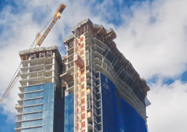
Layout for a high-rise curtain wall in Hawaii is dramatically streamlined with a 3D scanner paired with BIM software. It’s difficult for a structure to stand out on the Honolulu waterfront—the area is one of the busiest, yet most beautiful, on the island of Oahu. Home to Waikiki Beach, exclusive marinas, a breathtaking view of Diamond...

Fill out the Future of Surveying Questionnaire
Invest some time in the future of the profession – fill out the questionnaire! A monthly column in xyHt continues provide coverage of the Forum on the Future or Surveying (FFOS); a national initiative with representatives from 15 key surveying related associations to examine paths forward for the profession. See the first installment in our...
Book Review of Dr. Herbert Stoughton’s Journeys
Book Review Journeys: One Individual’s Excursions into the Surveying and Mapping Professions by Dr. Herbert Stoughton I have the honor and a pleasure to review the book referenced above, which I am going to call Journeys, and which was authored (at the request of the Professional Land Surveyors of Wyoming West Chapter) by Herbert W....

xyHt News Links: 4/8/16
Teledyne Optech Press Release: Teledyne Optech to unveil autonomous mapping system at SPAR 3D NCTech unveils new 360 degree imaging developments for iSTAR camera Teledyne Optech to announce new airborne system at ASPRS Imaging & Geospatial Technology Forum (IGTF) Trimble GNSS Options For CEESCOPE Teledyne to Acquire CARIS New Veripos GNSS Visualisation Software Fast Growing AirMap...

The Process of BIM
Above: An InfraWorks 360 model of downtown San Francisco. Image courtesy of Autodesk. An analysis of Autodesk’s software suite, BIM 360, reveals how BIM< can give project stakeholders unique access and insight across all phases of the AEC design process. Large modern buildings are permeated with sensors and systems—plumbing, electrical, heating, cooling, ventilation, security, elevators,...

“Sea Level Datum of 1929” — Did You Know?
I recently was consulted about the use of the term “Sea Level Datum of 1929” on plans and in engineering reports dating from the 1940-60s. The inquirer was concerned that this possibly meant that the work was based on something other than the National Geodetic Vertical Datum of 1929 (NGVD 29). As is often the...

