
Blog
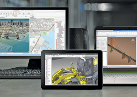
Virtual Desktop Infrastructure
VDI allows you to scale your computer performance based on your current needs, with each project administered and managed through central management consoles. The geospatial industry has seen an incredible jump in the use of technology over the last 20 years; however, the way that we interact with technology at our offices and in our...
Possibilities in 360 Video for AEC
University Student’s Virtual Reality Startup Seeks to Bring Value to 360 Video Technology – Beyond Entertainment and into AEC You have probably already seen 360 videos – all over the place. Likely you have seen these on a YouTube, or tried a virtual reality experience by inserting your smart phone into a simple VR stereo...

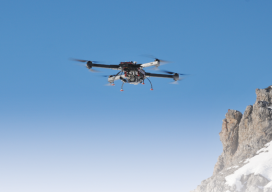
xyHt News Links: 4/15/16
New Autonomous Airborne Mapping Solution Redefines Industry Expectations Surphaser introduces a new 3D scanner and high precision mobile mapping system SurphSLAM Maptek releases Vulcan 10 and Maptek Workbench MAVinci SIRIUS UAS Surrey Satellite and BridgeSat to Develop Free-Space Satellite Optical Communications Solution Topcon announces global distribution agreement with VMT GmbH Carlson Software Releases Carlson SurvCE...
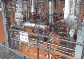
(Nearly) Symbiotic
Above: A 3D laser scan inside a facility, which will be processed into a BIM 3D model. Credit: 3CON, LLC BIM is quickly advancing for construction and survey. As long as humans have built environments, they have been surveying. And as the human imagination has spurred increasingly complex constructions, land survey tools and techniques have...
Shedding Light on Lidar
RIEGL USA’s CEO talks about the important trends in the lidar profession. For an inside look at the lidar profession, Heights interviewed James Van Rens, CEO of RIEGL USA. RIEGL provides a wide range of lidar scanning solutions for the aerial mapping and surveying profession, as well as mobile and terrestrial scanning applications. Van Rens...
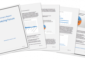
Multiple Choices
Forum on the Future of Surveying enters its initial feedback phase. This new column provides monthly coverage of the Forum on the Future of Surveying (FFOS)—a national initiative with representatives from 15 key surveying-related associations—to examine paths forward for the profession. See the first installment in our March issue. Now the initial report of the...
Advertisement