All posts by Matteo Luccio
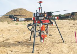
UAV Stakes Out New Ground
Above: A prototype of the Civdrone UAV preparing to drill a stake into the ground. A flying/staking robot has taken a huge step forward in automation for site layout, including road, rail, utilities, and energy applications. Working the traditional way, how many surveyor-days would it take to mark the 300,000 points needed to lay out a...
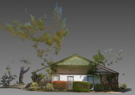
Accuracy with a Phone?
Photogrammetry is now possible using consumer devices, and the applications are vast. Continuing improvement in digital cameras—including those in cell phones—and in photogrammetry algorithms have enabled dozens of consumer and professional photogrammetric applications. Among the professional ones is PhotoModeler, which produces accurate maps, drawings, CAD data, 3D models, and photos draped on 3D models. Its...
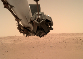
NASA’s Eyes on Mars
NASA’s InSight Mars lander took this image using its robotic arm-mounted Instrument Deployment Camera. Credit: NASA/JPL-Caltech. An old imaging technology is outdated for use on Earth, but it’s the perfect fit for today’s remote-sensing needs on Mars. Since 1960, at the dawn of the space age, humankind has launched dozens of missions to Mars, from...
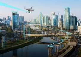
UAVs Enter the Sharing Economy
Above: A hypothetical Hangar mission plan for a city. A new platform connects UAV owners and UAV users while providing flight plans and image processing. As the UAV industry continues to grow rapidly, many companies are wondering whether they should own and operate their own UAV and, if they decide to purchase one, how they...
RFID Crazy
Above image: A Berntsen RFID reader is being used in conjunction with a smart phone. RFID-enabled infrastructure marking could become a cornerstone for a connected infrastructure management world. Imagine if all public works engineers and utility company crew chiefs were equipped with a mobile device that could easily and accurately identify every piece of infrastructure...
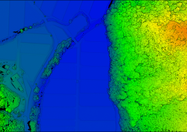
Standalone UAV Lidar
Above: The YellowScan Vx-20 collected this image in Hiroshima, Japan in May 2018. A surveying company developed a self-contained UAV lidar system so teams could gather data without a lidar specialist. Some companies are born (and some are transformed) when their founders switch their focus from using a tool for projects to developing that tool...